Graphics


Data Visualization
Data Visualization Specialist | Maricopa Association of Governments
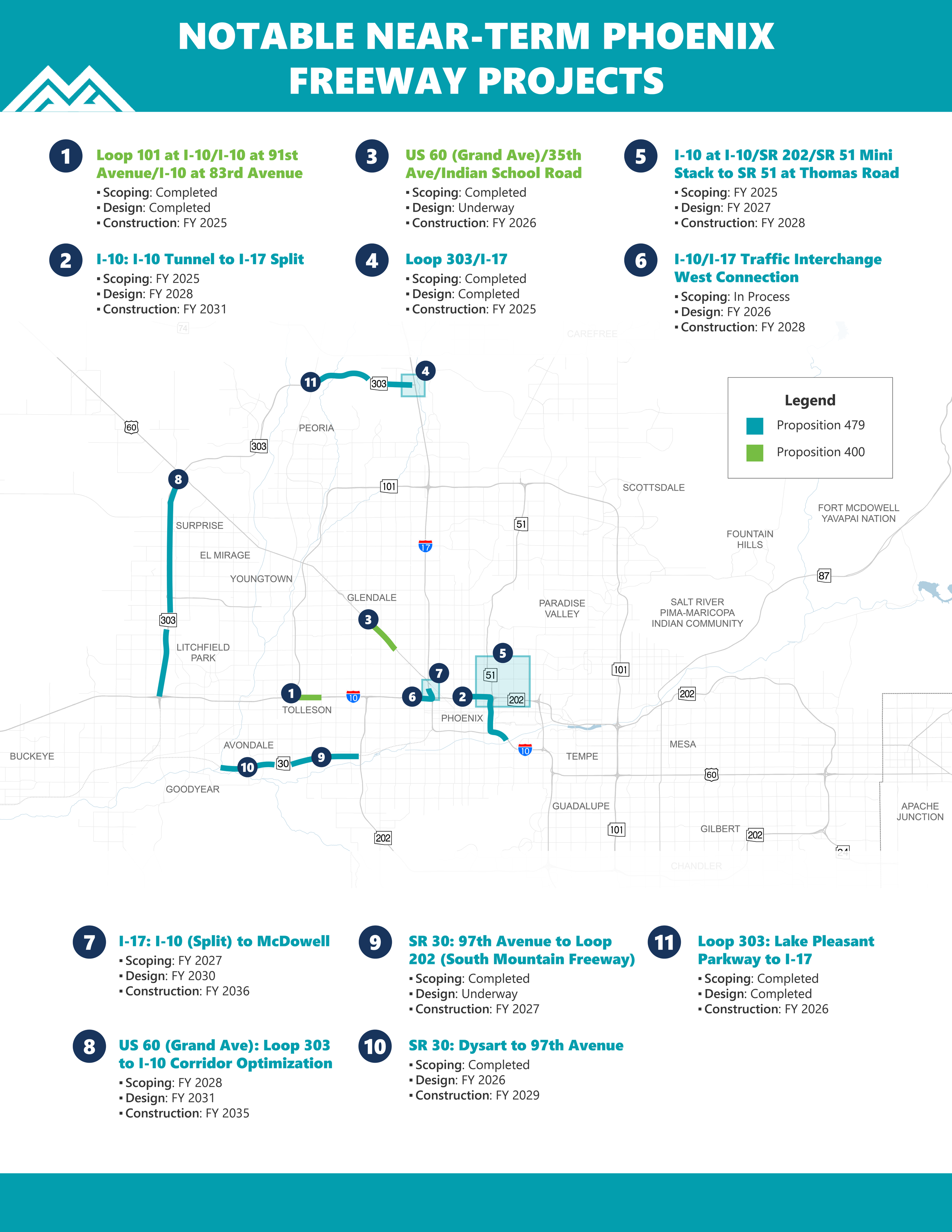
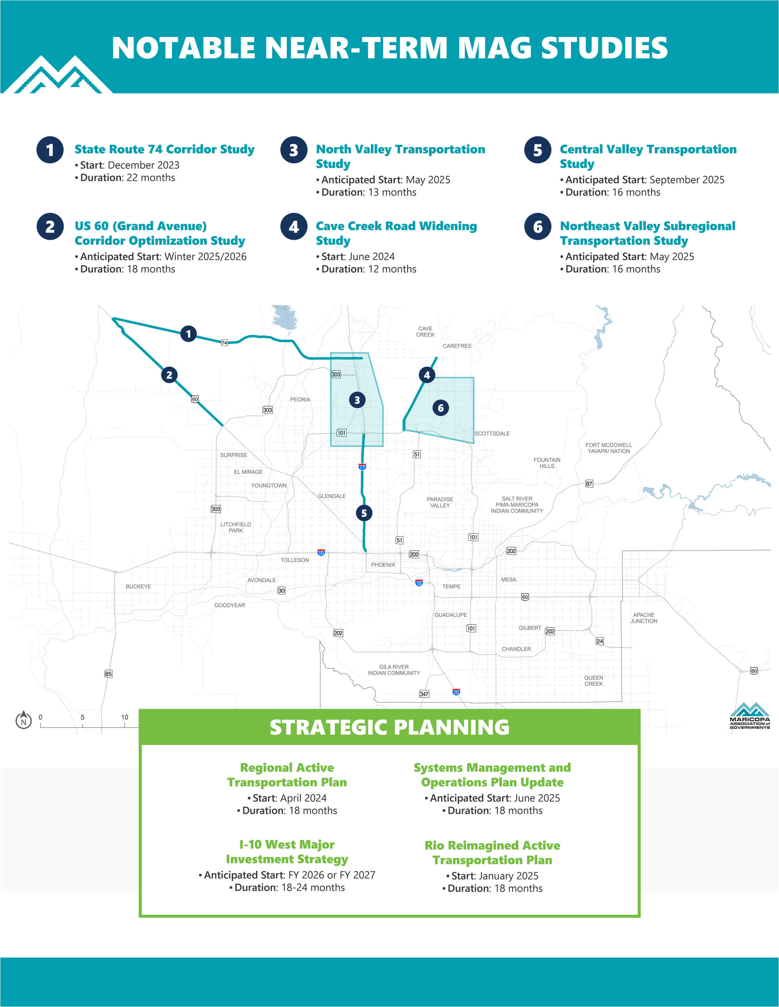
Designed a series of high-impact, one-page data visualizations to communicate regional infrastructure developments. A primary project, the Notable Near-Term Phoenix Freeway Projects, synthesized complex construction schedules into a streamlined map-based interface. I successfully integrated geographical data with project timelines and phasing status, providing stakeholders and the public with a clear roadmap of upcoming freeway improvements.
Client
Maricopa Association of Governments
Year
2025
Tools Used
Adobe Illustrator
Typographic Portrait
Tools Used
Adobe Photoshop & Illustrator

Original Photo of Princess Diana

Posterized Image

Initial Render

Final Typographic Portrait